Using remote sensing to measure the variation in suspended sediment in Gulf St. Vincent
In this remote sensing project, you will characterise historical variation in suspended sediment in Gulf St. Vincent and link this with measured and modelled estimates of suspended sediments.
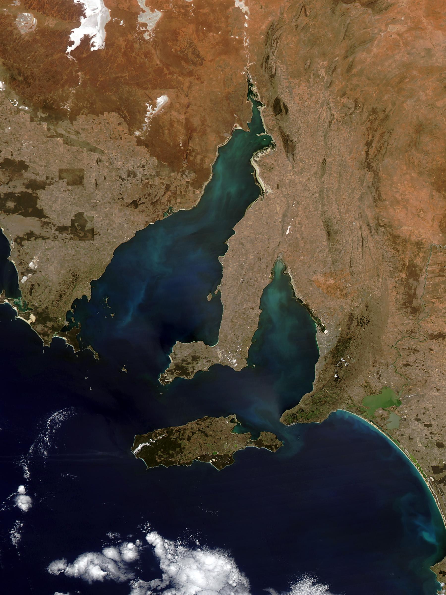
On February 29, 2016, the Moderate Resolution Imaging Spectroradiometer (MODIS) on NASA’s Aqua satellite captured this natural-colour image of colourful blue-green water off the coast of South Australia. The striking colours could be due to sediment brought to the surface when strong winds churn shallow waters. Some of the colour also could be due to phytoplankton - microscopic plant-like organisms that sometimes show up in this area.
NASA image by Jeff Schmaltz, LANCE/EOSDIS Rapid Response. Caption by Kathryn Hansen. We acknowledge the use of imagery provided by services from the Global Imagery Browse Services (GIBS), operated by NASA's Earth Science Data and Information System (ESDIS) Project.
Dr Ken Clarke’s research activities focus on making remote sensing and spatial science relevant.
“My team and I take existing research and convert it into useful information, using it to solve real-world problems,” Dr Clarke says.
“Or, if existing research is inadequate, we do the research ourselves, and then solve the management problem.
“We’ve got a long track record of working with government and industry and we frequently work across disciplines.
“Our experience covers a host of areas, including rangeland condition assessment; mapping seagrass meadows, and looking at how they’ve changed over time; developing ways to understand wetland inundation regimes, so we can manage them better; improving monitoring methods to help protect our arid mound springs; developing new ways of detecting and mapping bush-fire scars; and many others!”
Dr Clarke’s approach includes a strong logical basis for his team’s work, with firm roots in relevant theory - ecological, geological, remote sensing etc - as appropriate.
Sound literacy in critical thinking, computers and a specialist field such as ecology, geology, computer science, agriculture, astronomy, physics, robotics, or other are essential.
Some programming or scripting experience – for example, R or python) is ideal, but not necessary - you can pick it up as you go, it’ll be fun!
If you have your own ideas for an honours project, please contact Dr Clarke to discuss further.
Supervisor
Co-supervisors: Professor Megan Lewis
Research area: Applied remote sensing for real impact
Recommended honours enrolment: Honours in Ecology and Environmental Science