Scientists use novel remote sensing techniques to map ancient Aboriginal ‘tool-stone’ resources

University of Adelaide research that used hyperspectral imagery to identify surface deposits of silcrete, a rock used by Aboriginal peoples to create stone artefacts, has featured on the cover of the journal Geoarchaeology.
The remote sensing work of School of Biological Sciences PhD candidate W. Boone Law shows how desktop-based image analysis can assist researchers with the rapid production of highly accurate and targeted natural resource maps, reducing the need for costly and time-consuming field reconnaissance.
“Hyperspectral imagery can assist archaeological researchers to identify where siliceous rock lithologies occur; but possibly the greatest benefit of this research lies in its potential to save time, money, and improve research outcomes,” Boone says.
Above image: Featured on the front cover of the 2020 May/June edition of Geoarchaeology, W. Boone Law’s research is possibly the first Australian study to be featured on the cover of the journal, which has been in publication since 1986. View larger version.
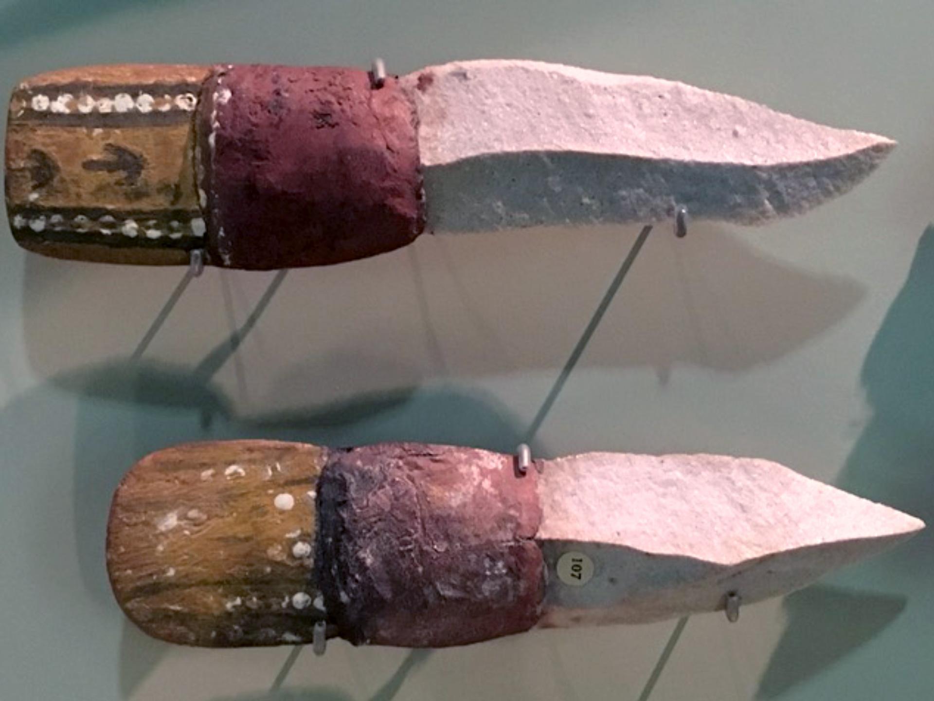
These knives collected from the northern Lake Eyre region of South Australia, on display at the South Australia Museum, are an example of the tools created using silcrete stone.
“In many parts of central Australia, silcrete is the principal raw material identified in the creation of artefacts and was used to make a wide range of stone tools.
“For the Indigenous peoples of far north South Australia, silcrete was an import commodity for their technological and socioeconomic system.
Identifying where lithic raw materials naturally occur is a topic of great interest for archaeologists.
“Researchers usually rely on geological maps, geomorphological land characteristics, artefact attributes, and conventional petrological characterisations to identify the origin of raw materials like silcrete,” Boone says.
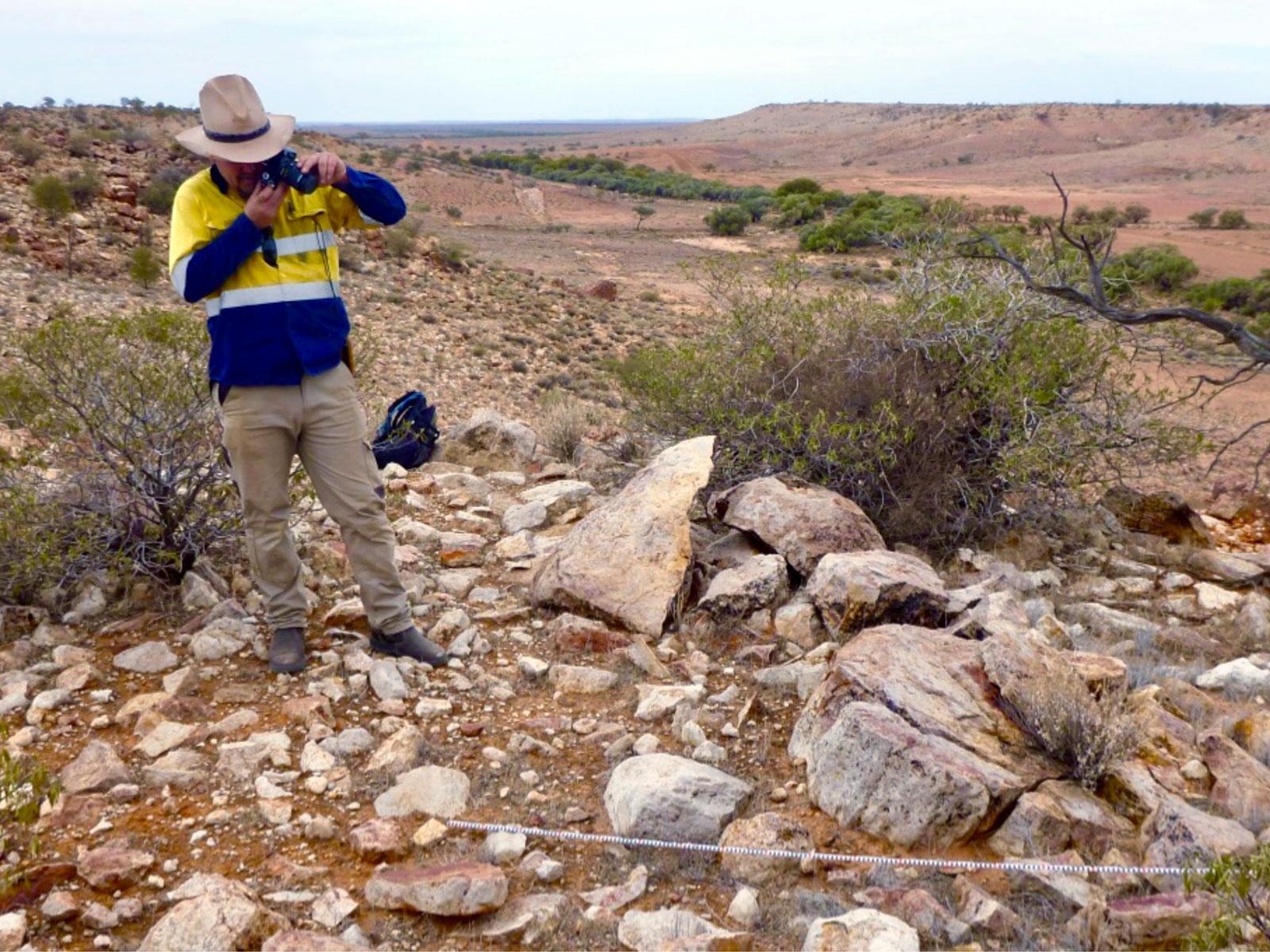
PhD candidate W. Boone Law photographs a silcrete outcrop after mapping its locations using novel remote sensing techniques.
“Pinpointing raw material sources is often a time‐consuming and labour‐intensive exercise, and frequently the precise location of the geological resource cannot be identified.
“Thus, further research using hyperspectral imagery to identify surface silcrete sources would be an efficient way to map the abundance and distribution of this resource in arid outback regions of Australia.”
Boone's research paper is co-authored by Professor Megan Lewis and Associate Professor Bertram Ostendorf from the University of Adelaide's Spatial Sciences Group and Professor Peter Hiscock of the University of Sydney.
The authors wish to acknowledge and pay respect to Traditional Owners and custodians of the lands in the greater Dalhousie Springs region, including the Southern Arrente, Wangkangurru and Indigenous peoples of the Irrwanyere Aboriginal Corporation.
Geoarchaeology is an international journal dedicated to original interdisciplinary scientific research where geographical, geological, geophysical and earth science techniques are used to better understand the archaeological record.
What is hyperspectral imagery?
Hyperspectral imagery is a form of optical remote sensing that records the reflectance of Earth surface materials in parts of the electromagnetic spectrum from the visible into the shortwave infrared (SWIR).
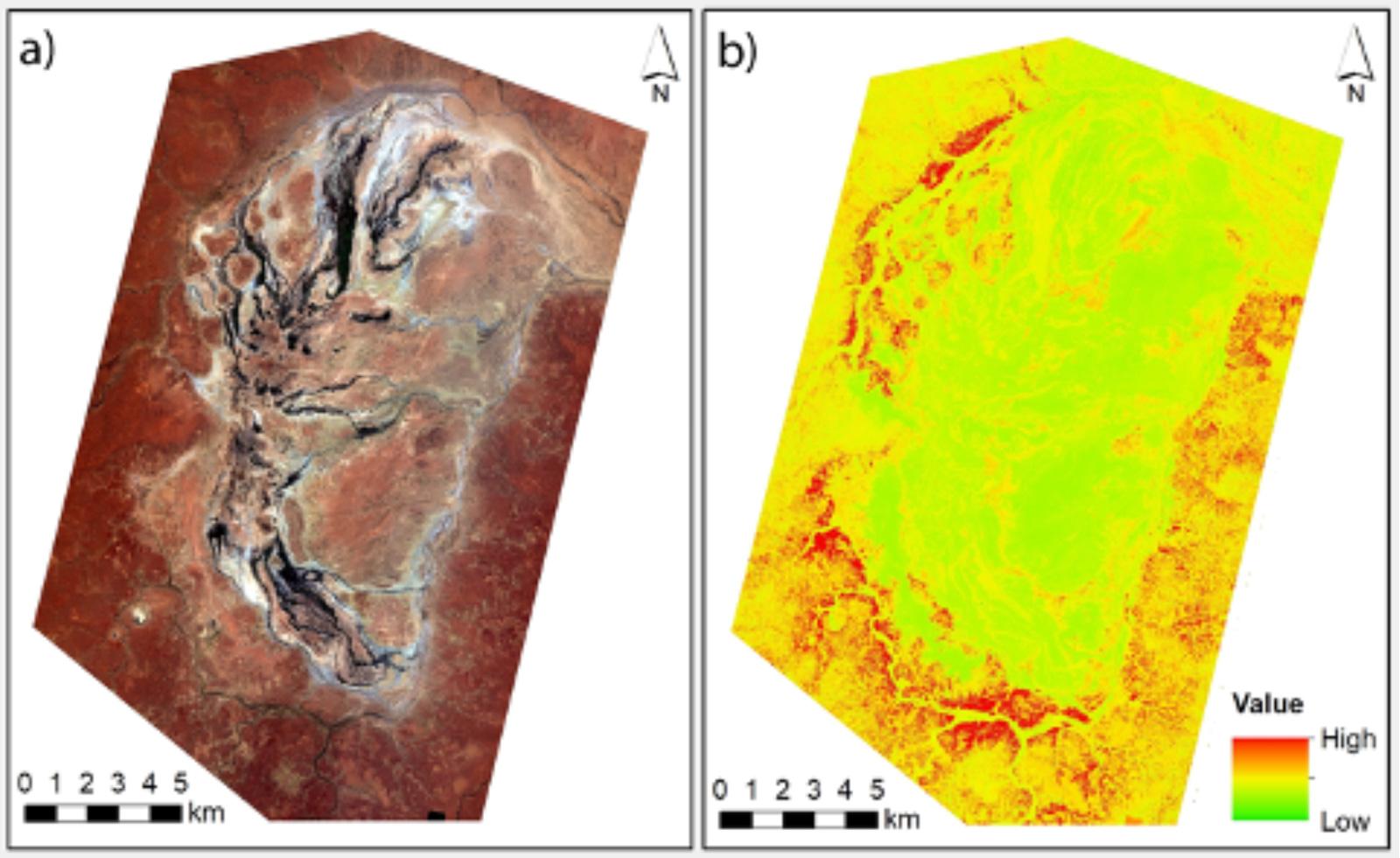
In this study, researchers used aerial hyperspectral imagery to identify hydrated silica‐bearing rocks such as silcrete, via a unique spectral feature in the SWIR.
Hyperspectral image analysis can target and reveal the distribution of Earth surface materials that not apparent in conventional true colour imagery (i.e. visible light).
- The left image (a) is true colour aerial overview image of the Dalhousie Springs study area in northern South Australia.
- The right image (b) is an analysed aerial hyperspectral image where a spectral fitting algorithm was used to identify pixels that match the shortwave infrared ‘spectral signature’ of hydrated silica-bearing rocks (red areas).
- Fieldwork confirmed the rocks to be silcrete.
Study remote sensing
Students interested in the environmental remote sensing and spatial science program at the University of Adelaide are invited to contact Professor Megan Lewis from the Spatial Sciences Group for more information.
Ecology & Spatial Science majors Spatial science honours projects
Further reading
Reflecting on siliceous rocks in central Australia: Using advanced remote sensing to map ancient “tool‐stone” resources, Geoarchaeology
This article has been adapted from the blog post published by the University of Adelaide's Environment Institute. Read the original article.