Spatial information, environmental remote sensing & GIS
Choose an honours project that uses spatial information tools and data - remote sensing, geographic information systems, spatial analysis and modelling.
Projects cover a wide range of applications and settings, including terrestrial, wetland and marine ecology, wildlife and habitats, land assessment and management and earth science.
These include:
- using spatial information to improve wildlife and habitat monitoring and management;
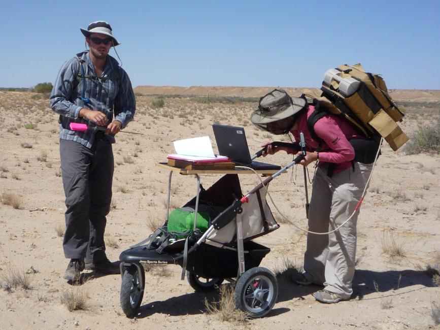
- monitoring environmental change over time using long-term satellite image time-series; and
- assessing land, habitat, vegetation, soil and water condition with new spatial tools and data.
Who should study honours in spatial information, environmental remote sensing & GIS?
These projects are aimed at students in science, natural resource management, environmental science, geography, geoscience and agriculture.
Students should have completed level 3 courses in GIS and/or Remote Sensing, but specific projects can be defined to suit different interests and skill levels. These projects provide opportunities for students to develop and apply their skills in spatial sciences and to network with potential employers.
Many of our projects conducted in collaboration with government agencies and outside partners such as the Department of Environment & Natural Resources and regional Natural Resource Management groups.
In addition, there is scope for projects that involve supervisors from other research areas.
Software and equipment available for use
- ERDAS Imagine, ENVI, IDL, ArcGIS and other image analysis software
- ASD FieldSpec Pro Visible-shortwave infrared spectroradiometer
- Unmanned aerial vehicles and a range of sensors: visible, infra-red and thermal cameras and video through collaboration with the Unmanned Research Aircraft Facility
- GIS & image data: access to national and international archives of many forms of satellite and airborne imagery & spatial data from broad to ultra-fine scales.
Supervisors
Professor Megan Lewis | Associate Professor Bertram Ostendorf
Co-supervisors: Dr David Taggart | Dr Ken Clarke | Dr Dorothy Turner
Research area: Spatial information, environmental remote sensing and GIS
Recommended honours enrolment: Honours in Ecology and Environmental Science